Winter Storm for Jan 9 -10th.
Significant event details and developments:
1. A powerful storm system is expected to impact the area on Tuesday, January 9 - Wednesday, January 10.
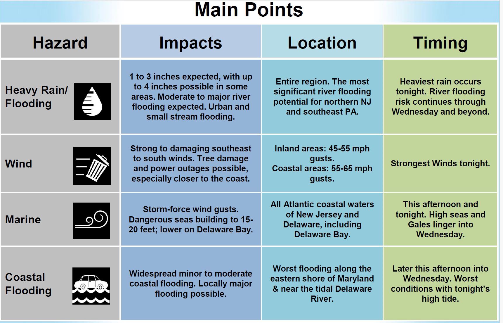
2. Montgomery County is currently at a Moderate Risk of Excessive rainfall.
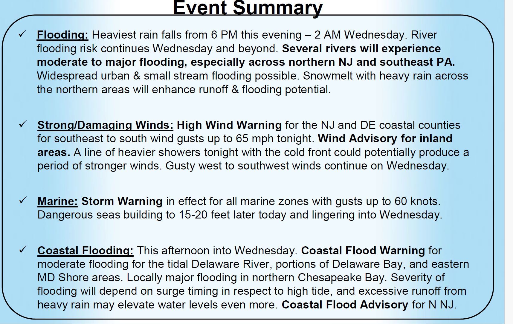
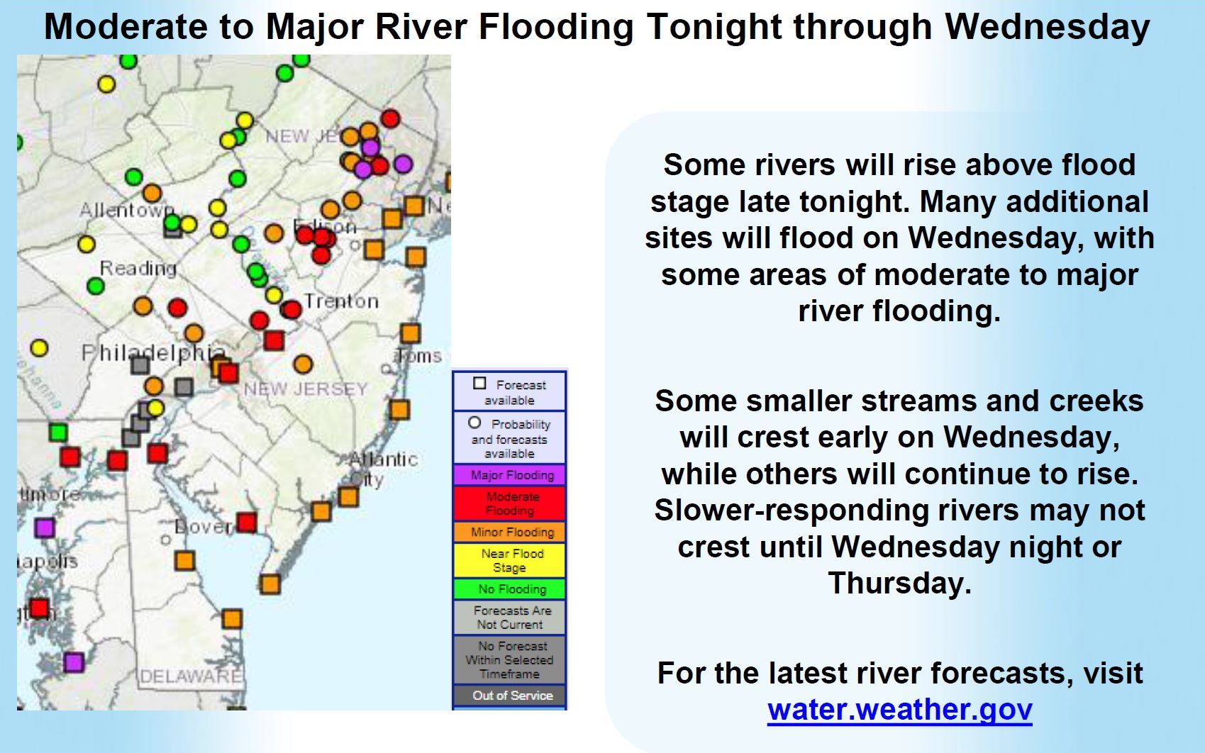
3. Widespread 2-3 inches with up to 4 inches of rainfall is possible in some areas. This may lead to widespread urban & small stream flooding and widespread moderate/major river flooding, especially for Northern NJ .
- Schuylkill River at Pottstown: Highest forecast 13.1ft at 1900hours 1/10/24
- Perkiomen Creek at Graterford: Highest forecast 13ft at 0700 hours 1/10/24
- Schuylkill River at Norristown: Highest forecasted 15.1ft at 1300 hours 1/10/24
4. Heaviest rain will occur Tuesday afternoon and Tuesday night. River flooding continues through Wednesday and beyond.
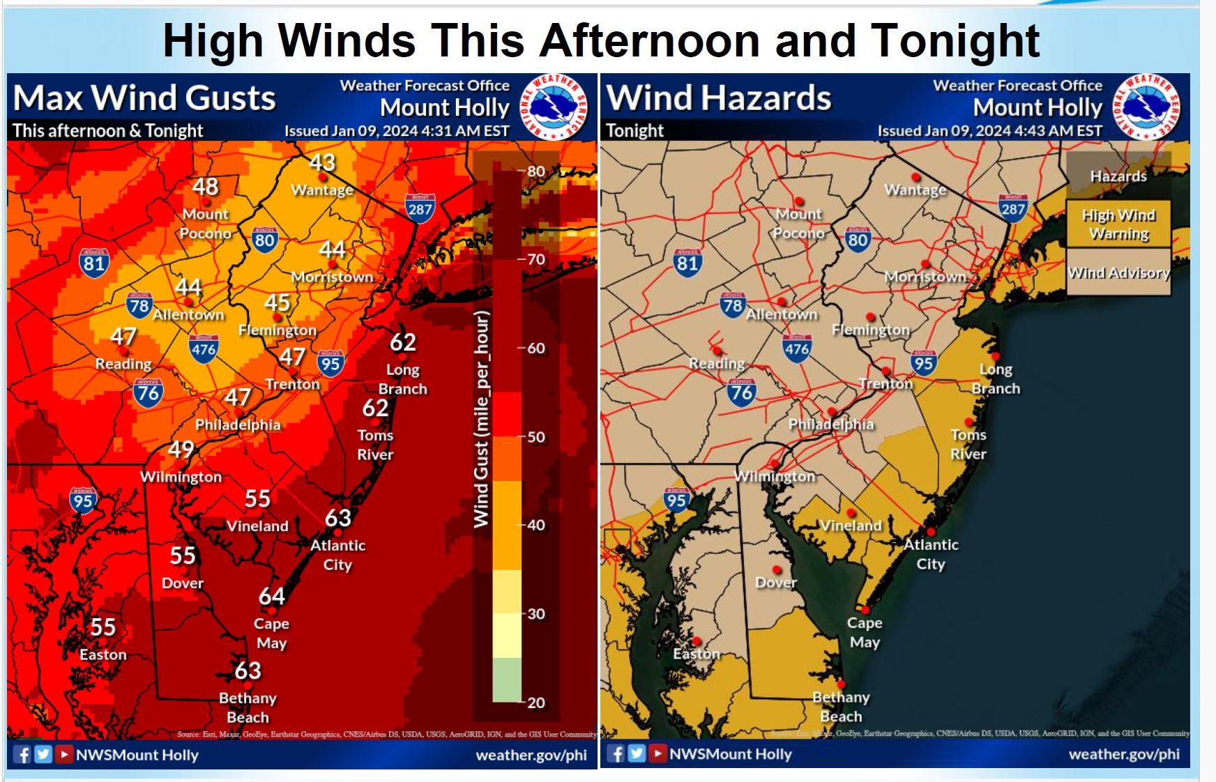
5. Very strong and damaging south to southeast winds between 40-50 mph for inland areas. The strongest winds occur on Tuesday night. Gusty westerly and southwesterly winds continue on Wednesday.
https://www.weather.gov/media/phi/current_briefing.pdf